How does your land trust use GIS and mapping?
Whether you do mapping through staff, volunteers or consultants, this checklist can help you assess your current approach, in order to improve conservation outcomes as well as to better meet Land Trust Alliance (LTA) Standards and Practices. Print this Best Practices page.
Best Practices for All Land Trusts
Almost any land trust will benefit by having the following elements in its mapping program:
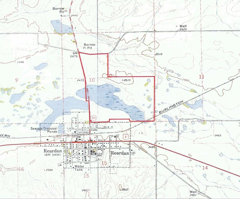
- GIS Database of Properties: A single, current GIS file with all of your property boundaries, and linked to other data about properties via a unique property ID number. Property boundaries should be either official tax parcel data or mapped at least at the accuracy of a USGS quad map.
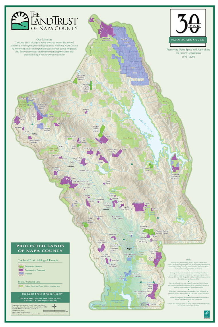
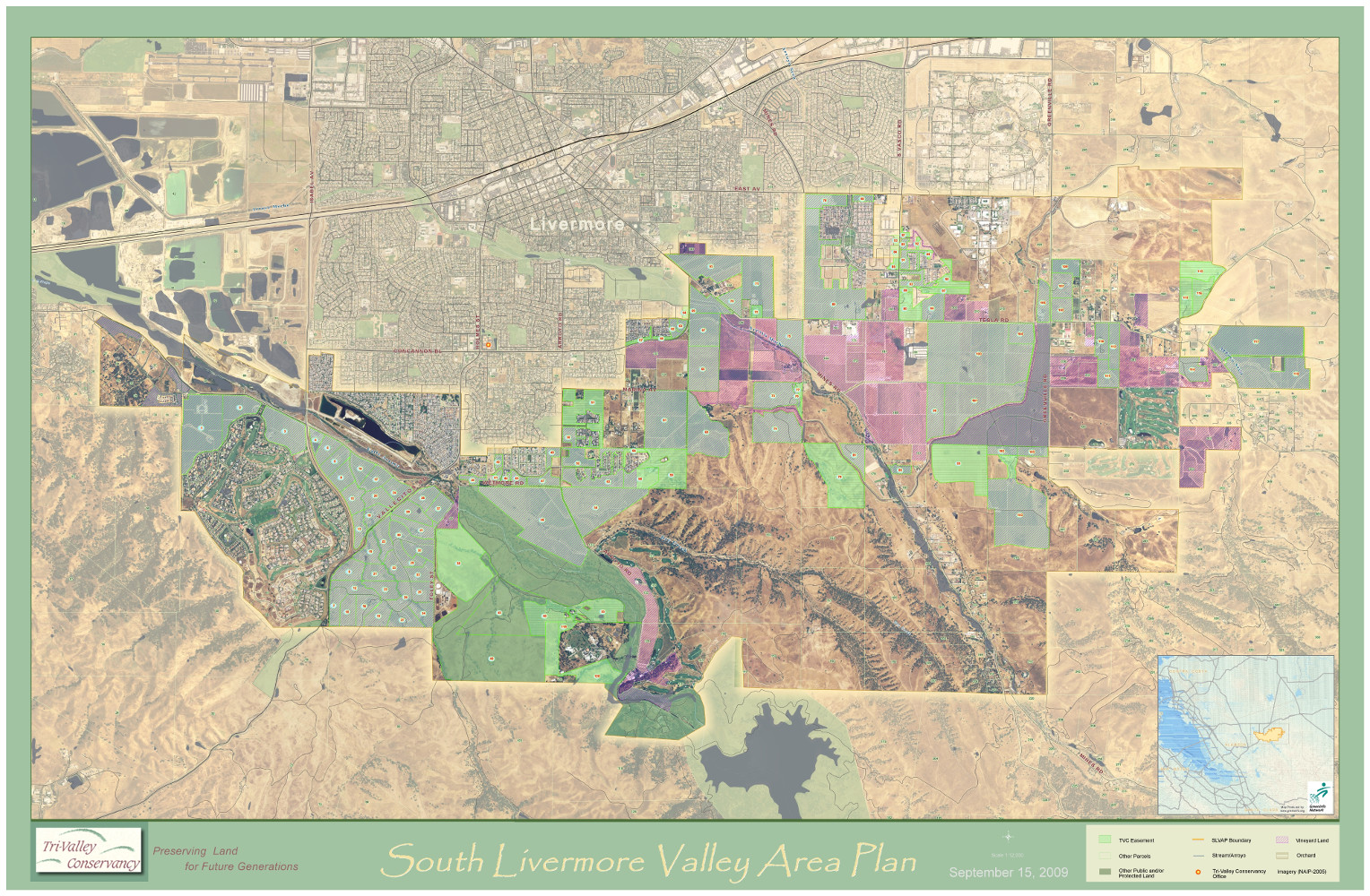
- Service Area Map Showing All Properties in Your Area of Work: Well designed graphic product showing all your holdings, and other protected lands in your area, plus other information (roads, water, topography, city limits, etc.).
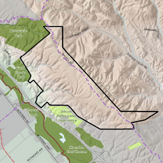
- Individual Property Maps: For each property, a standard GIS-based map showing property details (parcel lines, roads, contours, etc.), along with regional location. Can also be done over a high resolution air photograph.
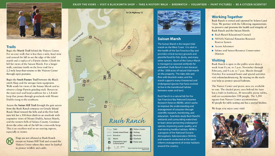
- Maps for Organizational Support: Print and digital maps of properties for use in grant proposals, donor communications, newsletters, PowerPoint presentations, etc.
- Basic Web Maps: Clear, attractive digital map images of service area and all holdings, and of individual properties. Maps may also be in PDF or other more printable forms, depending on your needs.
Best Practices for Advanced Use of GIS
Land trusts with more active programs will frequently want to apply the following mapping elements:
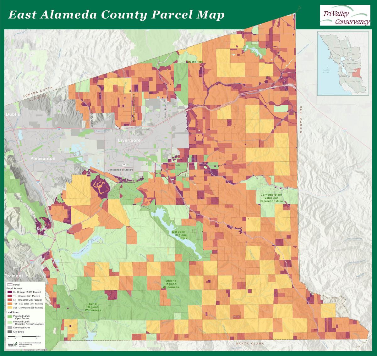
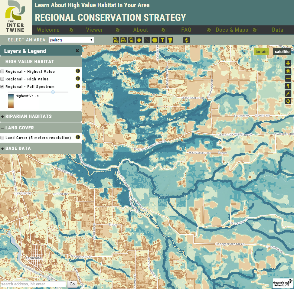
- Regional Landscape Assessment: A series of maps showing key factors in your land trust’s area of operations (and nearby lands): ownership, vegetation, jurisdictions, general plans, agricultural lands, watersheds, endangered species and other topics. More advanced maps might include visibility analysis, habitat corridors, lands at risk of development, etc.
- Priority Maps: One or more maps indicating areas or parcels considered to be high priority for conservation. These are often confidential and for internal use. Priority maps can also be more general, showing high value habitat areas, key working landscapes, desired recreational opportunities and linkages, etc.
- Detailed Property Acquisition Maps: For any particular acquisition, one or a series of maps showing exact features of the property, usually with official tax parcel boundaries and often including a version with a high resolution air photograph.
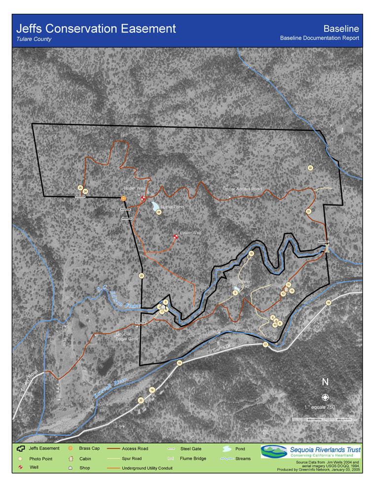
- Stewardship/Easement Monitoring: Key maps for each property, showing official property boundaries over an aerial photo, with monitoring points defined. Tied to ongoing easement monitoring reports, and can be supplemented with mobile GPS units, digital GPS cameras or smartphone data collection programs.
- Outreach/Fundraising Support: Maps showing land trust member locations, special property or service area maps customized for individual donors, map images created for grant proposals or other funding strategies. GIS can also be used to identify property owners near a proposed acquisition (e.g., within its viewshed), and it can be used to help target individuals in a community, filtering names and locations to point to higher probability supporters.
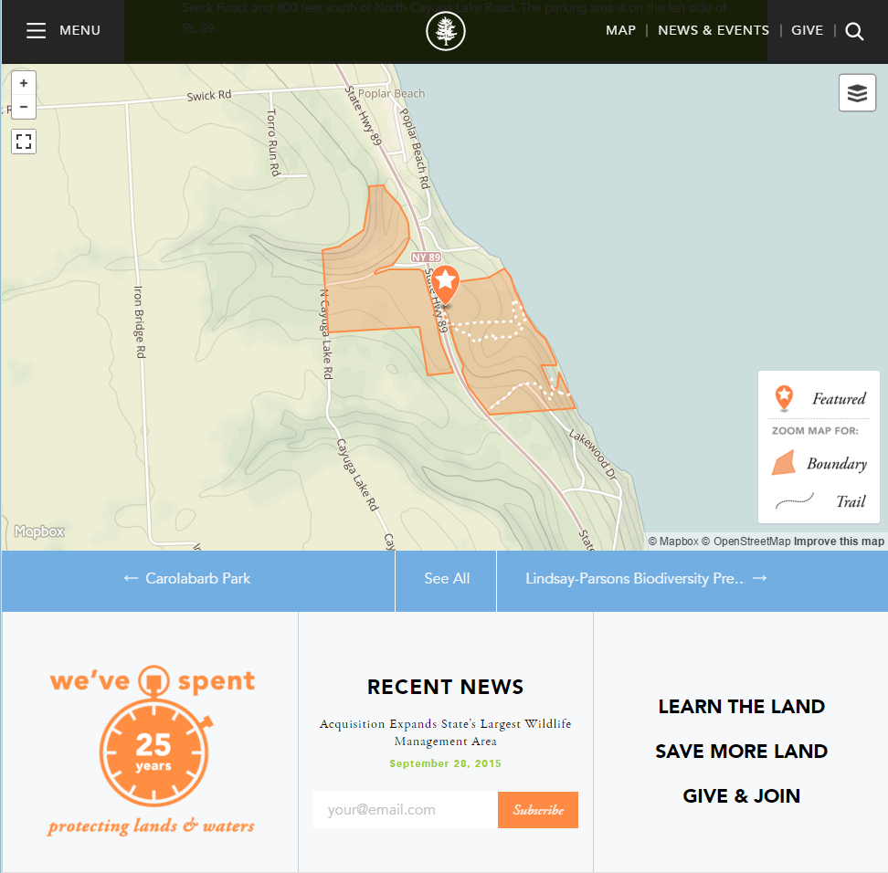
- Online Interactive Mapping: Interactive maps built into land trust web sites, showing their service area and holdings (plus other protected lands) – can be developed in Google Maps, MapBox, CARTO (CartoDB), or custom web mapping platforms. Land trusts can also use Esri Story Maps for virtual tours of properties.
- Results Tracking: Statistics generated by GIS about acres and other attributes in your property file, possibly grouped by other boundaries – for example, generating a list of land trust-protected (and other) acres in each county supervisor’s or other legislator’s district.
Best Practices for Large Land Trusts
For larger land trusts, the following mapping elements can be worth the investment they require:
- Full Conservation Planning: Usually done with a conservation planning consultant, this effort builds a more robust version of the landscape assessment and priority maps noted above. It often involves modeling or other data analysis, looking at the natural characteristics of concern to a land trust and relating them to each individual property in the land trust region. Conservation plans can be very effective but may require budgets of $25,000-100,000+.
- Advanced Stewardship: Using GPS technology coupled with GIS can greatly improve the accuracy of monitoring and create a more defensible framework for potential enforcement actions. For larger properties, using automated analysis of aerial images can track landscape changes, along with on-the-ground observations. GIS can also aid planning and implementation of restoration projects.
- Project Management/GIS Integration: Linking a GIS of land trust holdings to a database can greatly improve project management capacities, and can be used to generate regular data reports for use with staff, trustees, funders and others.
- Advanced Interactive Mapping: Custom web mapping applications or Esri's ArcGIS Online platform can give staff and/or trustees and volunteers access to GIS data generated in landscape assessment and planning, plus information about properties and their acquisition or monitoring status. Requires a relatively technical sophisticated capacity in the land trust and frequently a consultant to develop the application(s).
This best practices list is only a starting point – many land trusts will find other interesting uses of GIS and mapping approaches.
The cover photo at the top of this page is titled wyoming HDR#2 by greg westfall, licensed under CC BY 2.0