The Impact of GIS
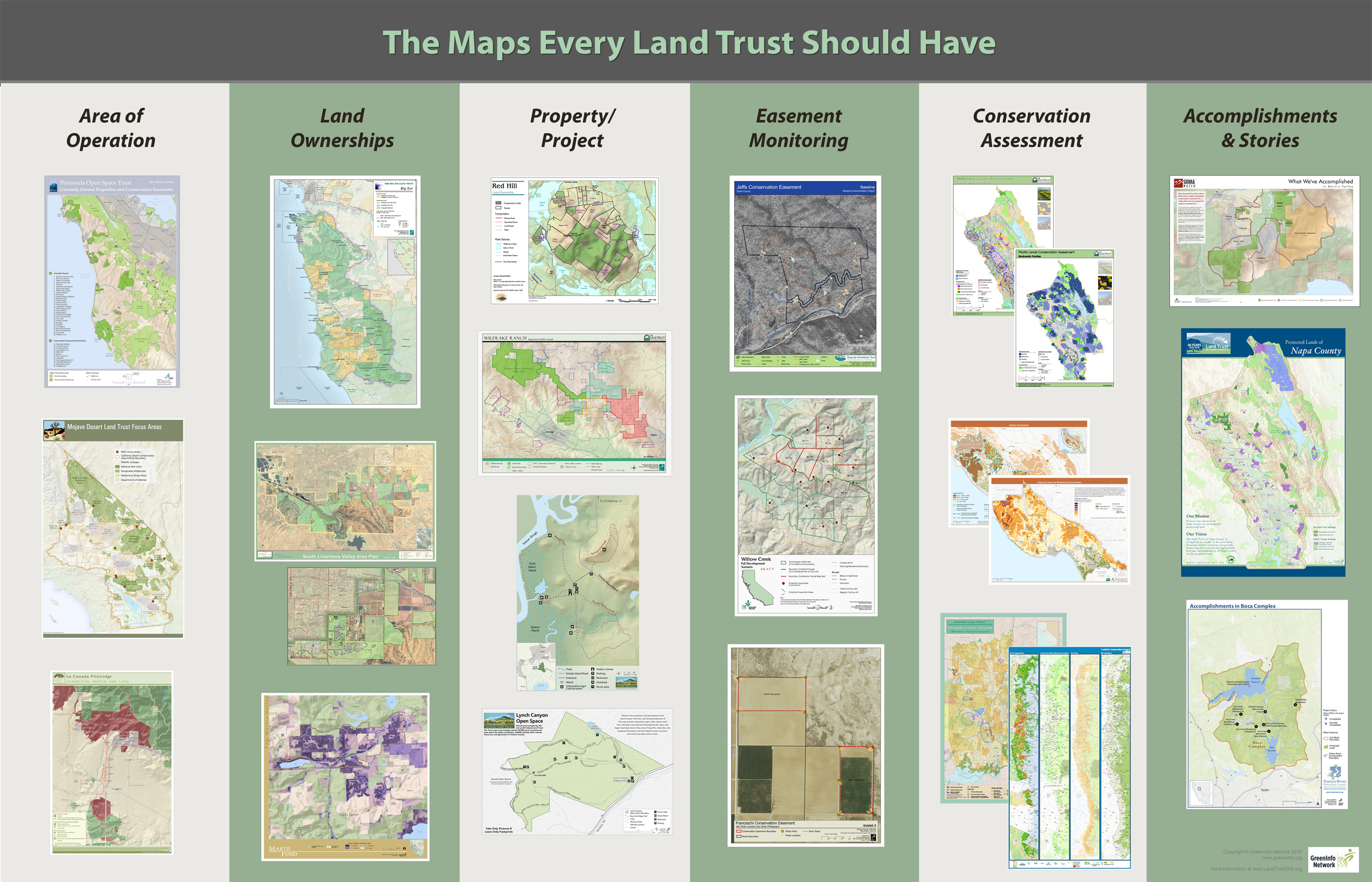
There are many types of maps that land trusts can and should incorporate into their work. The poster below showcases six types worth consideration. Here’s a PDF of this poster that you can download and print (PDF, 8mb file).
In addition to these map products, there are a wide range of interactive/web applications available on our Resources page.
Below are just a few land trusts out of the many using GIS that show a diversity of approaches land trusts use with geospatial technology. We expect to be adding more examples in the future — if you are a land trust using GIS actively, let us know.
Greenbelt - Essex County (Massachusetts) Land Trust of Napa County (California) Vermont Land Trust (Vermont)Greenbelt - Essex County (Massachusetts)
Organization website: ecga.org
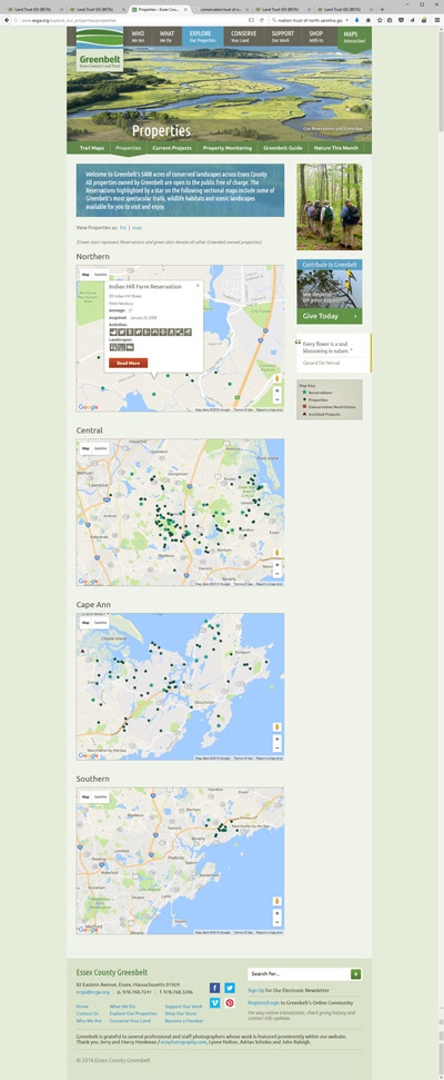
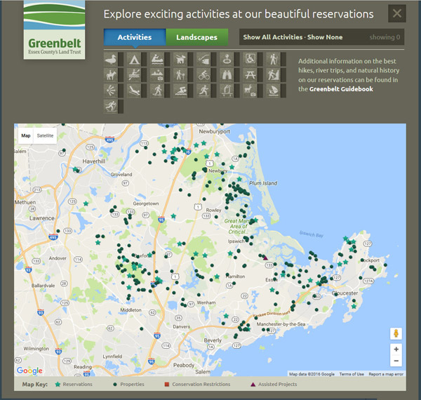
Greenbelt focuses on Essex County in Massachusetts. Since 1961, they’ve helped secure 21,500 acres of land and now have a 21-person staff, with many staff working on their maps and geospatial analysis/conservation planning. Greenbelt uses Esri ArcGIS software for data management and analysis and for basic map production, and supplements it with the work of a part-time staff designer.
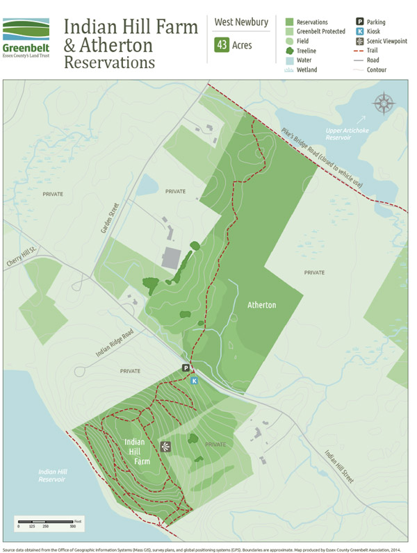
Of particular note are the series of trail maps they have created for their preserves: these are created as base maps in GIS, then imported into Adobe Indesign for framing, labeling and special features. Greenbelt illustrates how an organization’s brand can be extended to its mapping, with outstanding products the result.
Greenbelt also uses basic ArcGIS Maps SDK for JavaScript for point locations of its preserves.
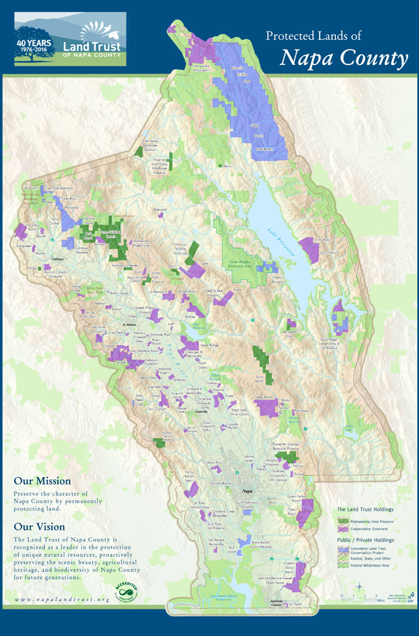
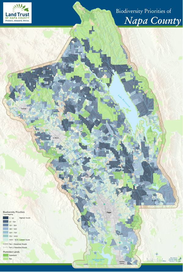
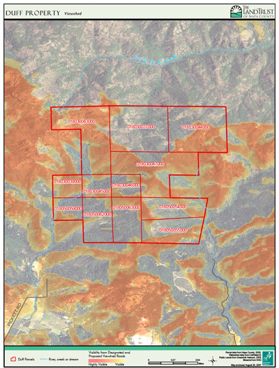
Land Trust of Napa County (California)
Organization website: napalandtrust.org
In northern California, the Land Trust of Napa County has evolved its use of GIS over a decade, going from simple project maps, to countywide posters, to full conservation planning and more sophisticated analysis of potential acquisition opportunities. This work is key in focusing the daily work of the trust, communicating to donors, keeping trustees informed and presenting the accomplishments of the trust to the public.
One of the key mapping efforts for the land trust is a conservation analysis created in partnership with NatureServe and GreenInfo Network, which provides a multi-view map framework for any prospective property including basic ownership and topography; protected areas nearby; conservation ranking, agricultural priority and viewsheds.
The Trust has been conserving land since 1976, and has protected over 96,000 acres through 275 projects. In addition to maintaining a GIS database of its properties (use ArcGIS software), the land trust has put special emphasis on its accomplishments mapping. Using a design created by its outside consultant, GreenInfo Network, the trust produces this map in poster and smaller formats and updates it annually.
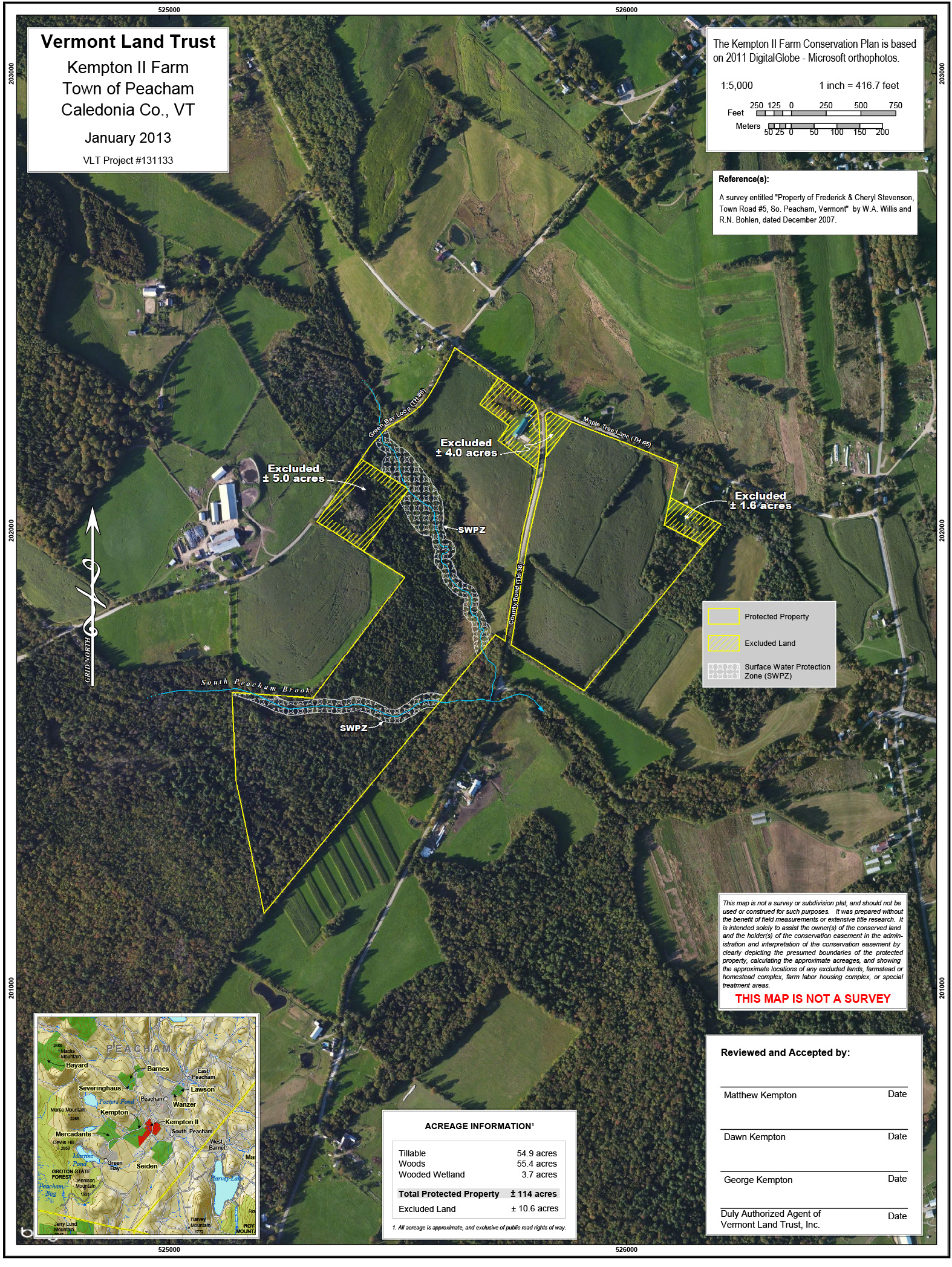
Vermont Land Trust (Vermont)
Organization website: vlt.org
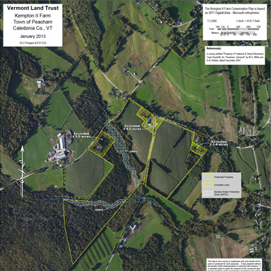
Covering the entire state, Vermont Land Trust (VLT) has a huge array of lands under conservation easement – more than 2,200 properties totaling over 640,000 acres. It has a staff of about 50, with a number of regional offices. Within that team are multiple GIS staff, plus a number of others who use the technology for stewardship, planning or other purposes. Of particular use are parcel/site maps, shown in the illustration.
VLT relies on ArcGIS which is run in their Montpelier, VT main office on a Citrix server to allow multi-user access to the main database. Most users run ArcMap. Some use is also made of the ArcGIS Operational Dashboard.
One particular use VLT makes of GIS technology is to support monitoring for their many field staff. Using ArcGIS Field Maps, the land trust staff log about 2,000 annual visits to conserved properties, data secured using the Field Maps application that is uploaded into their server for use in reporting and long term documentation. Field Maps is also used for baseline documentation, but supplemented with a dedicated GPS device.
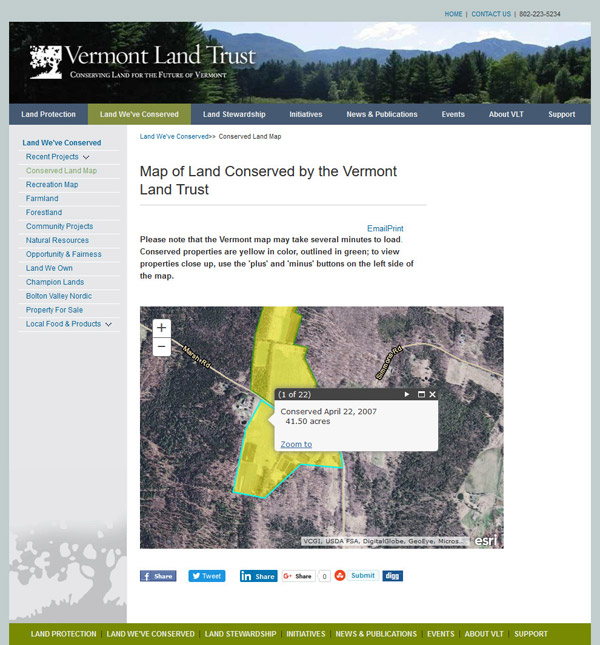
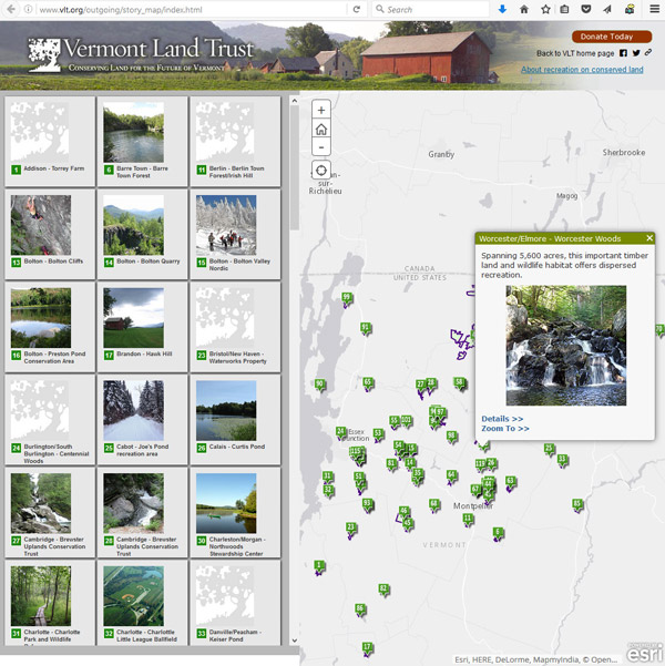
Its online mapping includes a map that has recreation opportunities and thousands of individual acquisitions in the state that are mapped at parcel level, which is developed with Leaflet JS.
The cover photo at the top of this page is titled Grandview Farm 2016 by This.Usually.Works, licensed under CC BY-NC-ND 2.0